
Surveying Featured Project
Project Name: Shell Mars Pipeline Marsh Restoration
Project
Photos
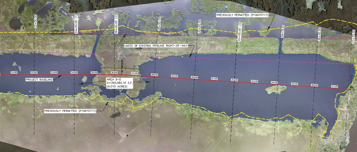
Providence provided a hydrographic and topographic survey of four areas to determine current water depths and extent of each individual area targeted for restoration. An Unmanned Aerial System (UAS) was used to produce high resolution orthomosaic imagery of each area. Conditions such as temperature, precipitation, maximum wind speed, and visibility were monitored to select the optimal day to conduct the flight. A network of 20 ground control points (GCP) were staked out via a GNSS RTK rover, utilizing Geoid 12b C4GNETdata corrections. The GCP was referenced to Horizontal Datum NAD83 State Plane, Louisiana South Zone 1702, US Survey feet and Vertical Datum NAVD88 Geoid 12A. Each site was accessed via airboat and once near the target locations, the Pilot in Command configured the aircraft for autonomous flight and confirmed that the fail-safe recovery mode was engaged.